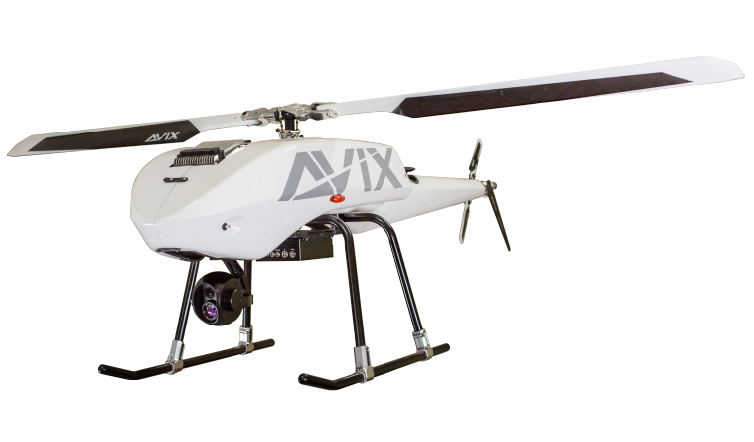
AXH-E230RS a professional multi-function unmanned helicopter, specially designed for the long-distance reconnaissance and surveillance application.
AXH-E230RS featured with high payload capacity, high mobility, low noise, low vibration, long endurance etc.
AXH-E230RS, in terms of its basic system configuration, is divided into 5 sub-systems and based on high-tech integrated design. It adopts the electric power single rotor design helicopter AXH-E230, in which and autopilot system is fully built-in and is available to perform and autonomous take-off and landing navigation missions. The front part of the body is loaded with a high resolution EO and IR dual cores in a compact 3-axis stabilized PTZ AXG-D30 gimbal.
As for the ground side, the operating of the PC interface mission software enables the mission planning to connect with drone side autopilot system AIC through the high efficiency ground control station AIB. During of flight mission, a real-time monitor is available and has no problem to take every control of the drone on the mission software through AIB GCS.
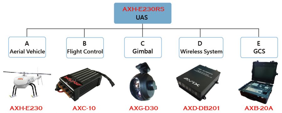
System Contents
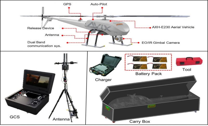 [/tab][tab title=”Specification”]
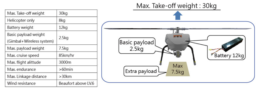
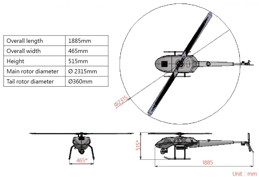 [/tab][tab title=”Features”]
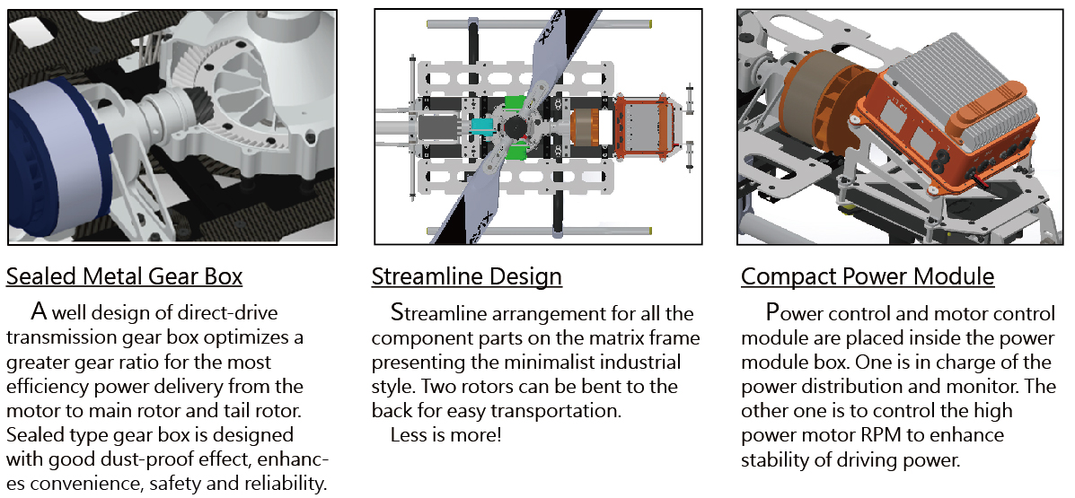
Flight Control System
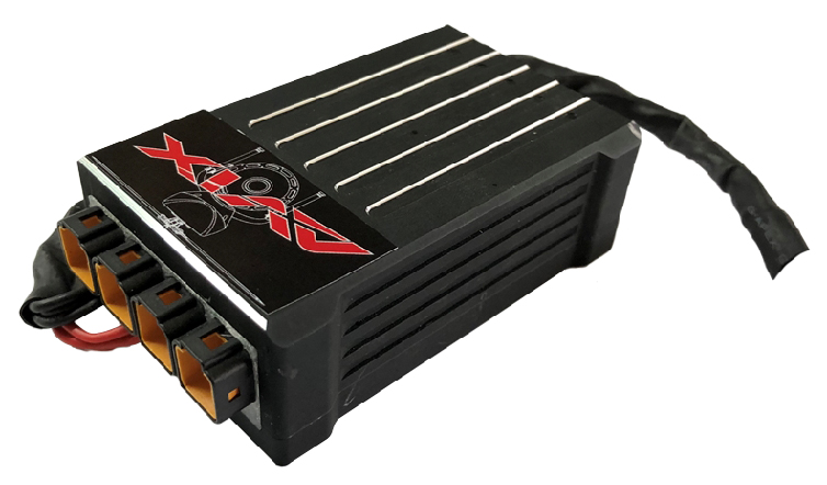
AIC built-in sensing unit integrated six-degrees of freedom inertial MENS sensor(MENS IMU), 3-axis magnetic compass, and a high sensitivity GNSS (GPS & GLONASS) receiver. Combined with the precise GPS assisted correcting to achieve the IMU to perform the high accuracy navigation flight control.
Data processing by UKF algorithm ensures accuracy, stability and fast convergence AHRS information for well execution of high accuracy attitude and heading flight control.
Read more AXC-10 Flight Control System
EO/IR Gimbal

AXG-D30 built-in high resolution EO and IR dual cores in a compact 3-axis stabilizes PTZ gimbal. The mounting mechanism adopts the quick-release design which has made the gimbal easily removed.
Operated by the exclusive software and through the IP interface, the gimbal is well connected with the wireless linkage system, the downlink image and uplink PTZ control command can be linked with the GCS directly.
Wireless Communication System
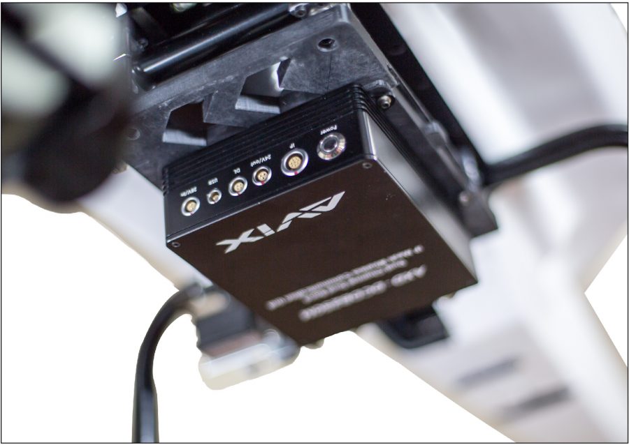
AXD-DB201 Dual Channel Dual Band IP Mesh Communication Unit is specially designed to integrate dual band RF modems to perform dual channel wireless communication. Features with full integration, compact size and light weight, AXD-DB201 can be widely used on the drone, land vehicle and it is man-portable.
AXD-DB201 units are combined in a fluid, self-forming, self-healing IP Mesh function which offer true networked integration of video, data, audio and GPS data. Offering genuine non-line of sight coverage using CPFDM technology, the system is highly mobile and full automated, and therefore create a network with extend range, one which will deliver in environment too tough for other wireless radio solutions to cope with.
Read more AXD-DB201 Wireless Communication System
Ground Control Station
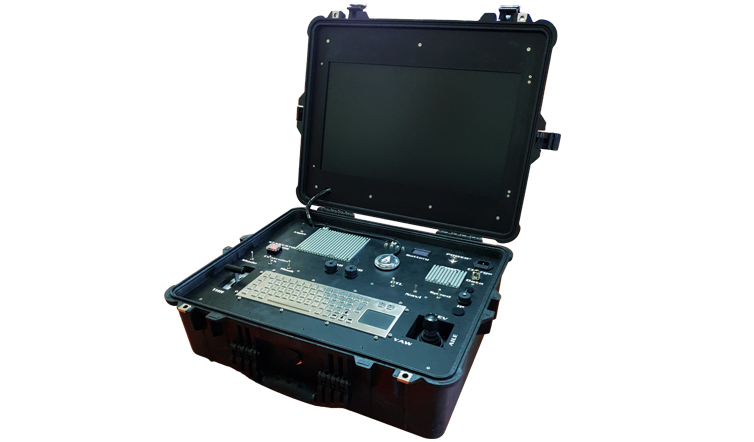
AXB-20A is a highly integrated GCS by a military-grade rugged plastic case. The built-in digital transmission module maintains real-time linkage of the data & video with the drone side.
Built-in industrial high-brightness screens monitoring the vehicle situation and video through the exclusive GCS software. The control panel is well functioned with the control stick and buttons, facilitate the execution of flight control.
Read more AXB-20A Ground Control System
[/tab][tab title=”Application”]
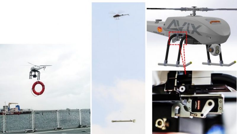
Hanging & Throwing
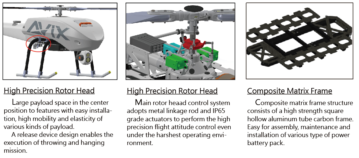
A release device design enables the execution of the throwing and hanging mission.
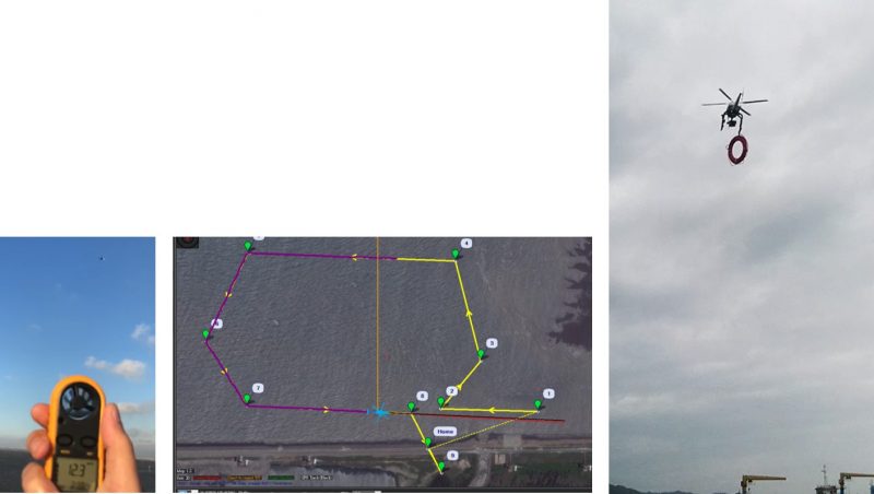
Navigation Flight Under 6-grade Strong Wind
The testing of navigation flight under unsteady 6- grade strong wind, AXH-E230RS obtains an accurate navigation flight following the original setting of navigation flight path by the high power driven and precision flight control system.
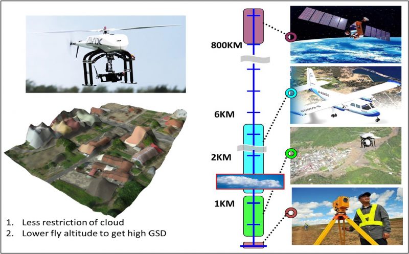
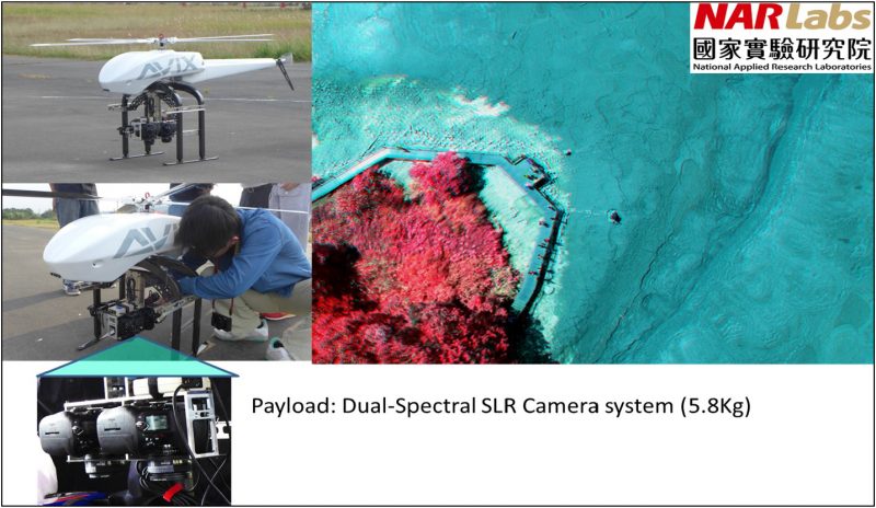
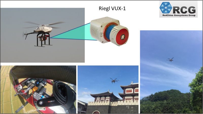
Survey & Mapping

▼Hyperspectral
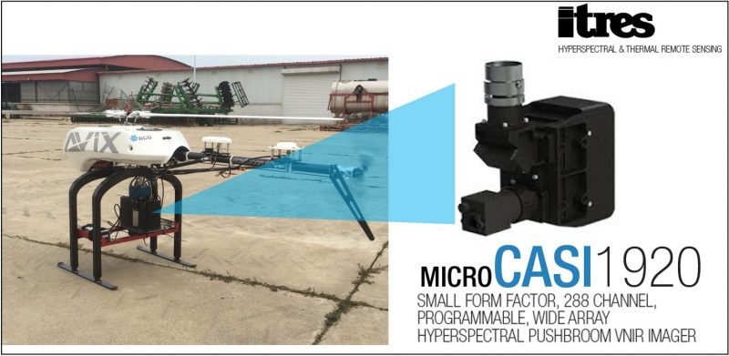
▼Hyperspectral

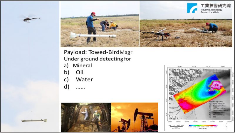
Mineral / Oil..
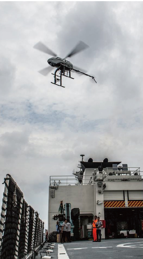
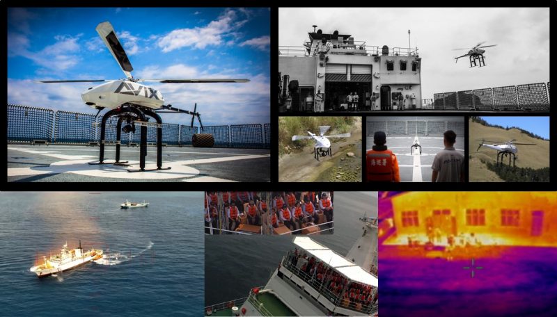
Reconnaissance & Surveillance

 [/tab][/tabs]


